
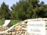
Massif de Castillon


Presentation
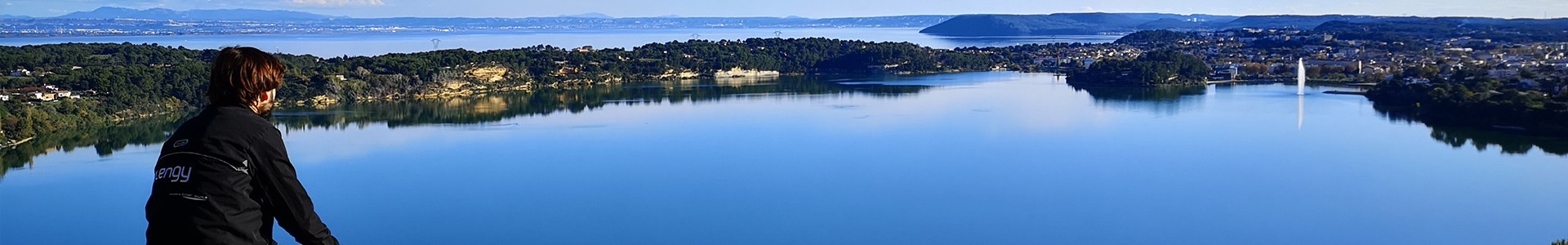
Also referred to as the Massif des Etangs, the Massif de Castillon is located to the South of the Bouches-du-Rhône, between Etang de Berre lake and the Gulf of Fos (Golfe de Fos). Of relatively small size (less than 10,000 acres),
The Massif de Castillon comprises a more or less continuous stretch of small, low-lying and wooded brows, with a fairly uneven relief, linking two small, North-South facing chains situated at the eastern and western ends of the massif.
This massif is located at the limit of the Bas Rhône and coastal Provence climate zones. …
Average temperatures there are warm (13 to 14 °C) and variations are tempered by maritime influences. Rainfall is low: between 500 and 700 mm/year on average, although sea mist generally causes humidity to rise.
Despite its predominant North-South topography, this massif is located along the Rhône valley and as such is exposed to frequent, strong and sometimes violent Mistral winds.
Part of the small series of chalky, secondary ranges known as the Chaînons, the Massif de Castillon is characterized by fairly dense forestation (59 %), despite high urban pressure. …
Its tree populations mainly comprise adult Aleppo pines (90 %) with local substages of evergreen oaks, plus dense areas of young Aleppo pines which have re-seeded further to forest fires (15 % of natural surface area) and a few areas of garrigue and heath with more-or-less stationary vegetation.
The Massif de Castillon is a genuine green lung, home to a wealth of natural and archaeological riches, set within a highly-developed and industrialised area. The proximity of Etang de Berre and presence of 4 lakes adjacent to the forest environment make it a popular place of call for avifauna (it is home to numerous Natural Zones of Ecological, Faunistic and Floristic Interest (ZNIEFF) and two Natura 2000 sites).
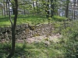
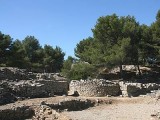
These natural treasures are crowned with an outstanding archaeological heritage at Domaine de Castillon, including the Saint-Blaise archaeological site and numerous remains inside the forest (ancient roads, tombs, etc.).
But the Massif de Castillon is also characterised by major peri-urban influences, with a highly-developed central area (many isolated or widely spread houses) and sophisticated communications network.
Human activity in the forest is also of note (Valentoulin and Trappil dumps).
This strong human presence, coupled with the massif's attractiveness, has led to high demand in terms of public welcome, in particular at Domaine de Castillon (450,000 visitors/year), the Saint-Blaise archaeological site, and Parc de Figuerolles (300,000 visitors/year).
An extremely popular "Forest Welcome Site" (ZAPEF) has now been opened at Parc de Figuerolles, forming part of the town of Martigues.
The Massif de Castillon comprises a more or less continuous stretch of small, low-lying and wooded brows, with a fairly uneven relief, linking two small, North-South facing chains situated at the eastern and western ends of the massif.
This massif is located at the limit of the Bas Rhône and coastal Provence climate zones. …
Average temperatures there are warm (13 to 14 °C) and variations are tempered by maritime influences. Rainfall is low: between 500 and 700 mm/year on average, although sea mist generally causes humidity to rise.
Despite its predominant North-South topography, this massif is located along the Rhône valley and as such is exposed to frequent, strong and sometimes violent Mistral winds.
Part of the small series of chalky, secondary ranges known as the Chaînons, the Massif de Castillon is characterized by fairly dense forestation (59 %), despite high urban pressure. …
Its tree populations mainly comprise adult Aleppo pines (90 %) with local substages of evergreen oaks, plus dense areas of young Aleppo pines which have re-seeded further to forest fires (15 % of natural surface area) and a few areas of garrigue and heath with more-or-less stationary vegetation.
The Massif de Castillon is a genuine green lung, home to a wealth of natural and archaeological riches, set within a highly-developed and industrialised area. The proximity of Etang de Berre and presence of 4 lakes adjacent to the forest environment make it a popular place of call for avifauna (it is home to numerous Natural Zones of Ecological, Faunistic and Floristic Interest (ZNIEFF) and two Natura 2000 sites).
These natural treasures are crowned with an outstanding archaeological heritage at Domaine de Castillon, including the Saint-Blaise archaeological site and numerous remains inside the forest (ancient roads, tombs, etc.).
But the Massif de Castillon is also characterised by major peri-urban influences, with a highly-developed central area (many isolated or widely spread houses) and sophisticated communications network.
Human activity in the forest is also of note (Valentoulin and Trappil dumps).
This strong human presence, coupled with the massif's attractiveness, has led to high demand in terms of public welcome, in particular at Domaine de Castillon (450,000 visitors/year), the Saint-Blaise archaeological site, and Parc de Figuerolles (300,000 visitors/year).
An extremely popular "Forest Welcome Site" (ZAPEF) has now been opened at Parc de Figuerolles, forming part of the town of Martigues.
Contact
Massif de Castillon

Destination
Massif de Castillon
GPS coordinates
Latitude : 43.44010
Longitude : 4.98281
Condition d'acces : In summer, the countryside is more at risk from fire. So, to protect walkers and beauty spots, access to forested areas is regulated depending on weather conditions from 1st June to 30th September. You may “feel like a walk” but phone 0811 20 13 13 before you set out. Every day, you can fi nd out whether the place in which you want to walk is accessible all day, open in the mor ning only or completely closed. The information on the voice server is available in French and English.